SailGrib WR adopts Geogarage maps

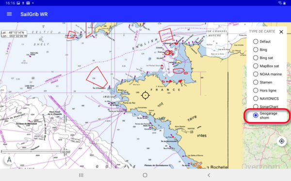
Collaboration is progressing between SailGrib et Weather4D. The recent version SailGrib WR 6.0 adds support for platform maps Geogarage including the international catalogs of SHOM and UKHO from around twenty publishers. These “tiled” raster maps are mainly based on digital data from official hydrographic services., or more than 10.000 maps available today, and viewable on their interactive catalog.

Unlike the majority of private providers, Geogarage offers subscriptions by publisher, and not by geographical area (¹). These are renewable annual subscriptions allowing regular updates. The icing on the cake is the pooling of subscriptions between Android and iOS devices : an account created on the Geogarage platform allows you to download subscribed maps to an iPad with Weather4D Routing & Navigation and an Android smartphone with SailGrib WR, or conversely an Android tablet and an iPhone with their respective application, up to five different devices. Read more …

SailGrib VR – Dedicated routing for Virtual Regatta

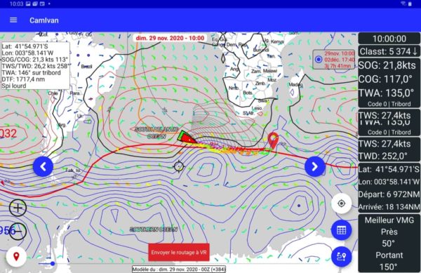
The brand new SailGrib application is available on the Google Play. SailGrib pour Virtual Regatta is solely dedicated to gaming. It brings the power of SailGrib routing optimized for Virtual Regatta enthusiasts while retaining the ergonomic and popular interface of other SailGrib applications..

By opening the application, once your Virtual Regatta credentials have been entered, you are then instantly connected to your account. By default the application opens on the last connected race. If you have other races in progress, you select them in the side menu (navigation drawer).

Position et trace du bateau affichés en temps réel

Position and track of the boat displayed in real time

Without any manipulation or adjustment, find your position displayed in real time on the planisphere. If a new weather file is available for the game, it will be automatically downloaded when opened. This is the same 1° GFS model that is used in the game. Read more …

Routing : from game to reality (Continue)

Vendredi 13 novembre ne sera pas un jour de chance pour les skippers du Vendée Globe 2020 (¹). Ils vont devoir négocier la rencontre avec la tempête tropicale « Theta » qui croise leur parcours avec des vents moyens pouvant atteindre les 40 nœuds et de puissantes rafales. Surtout la mer sera à craindre car, fortement croisées au passage du centre dépressionnaire, les vagues pourront dépasser les 6 mètres et déferler de façon chaotique. Read more …

Routing : from game to reality

On the second day of racing of this Vendée Globe 2020, we can say that the weather conditions that the skippers will experience on the descent towards the Doldrums will be particularly tough. After leaving in lousy weather, a first not very active cold front passed without incident, the loners will cross a second, much more violent front during the night and morning from Tuesday to Wednesday, for the group going to the West, and in the evening for the group passed between the DST (¹) and la in French.

But these future conditions are very different for Virtual Regatta players and for sailors… Read more …

Android Marine sets sail for the Vendée Globe 2020

Oh yes, everything happens ! In my entire computer-nautical career I had never played any computer game whatsoever., not even the historic Windows card game that cost businesses thousands of idle office hours… but you should never say : Never !

Or donc, here I am registered for Virtual Regatta, one among the most 340.000 players registered at this time, ready to start the Vendée Globe tomorrow at 1:02 p.m.. Like any beginner, I watched a few videos to quickly understand this game, Who, we are all, seems relatively simple for an experienced sailor. But from there to playing in the big leagues, there are still several oceans to cross !

Read more …

GNS 3000 Bluetooth GPS receiver for mobiles

The new GNS 3000 announced by Global Navigation Systems since last spring is finally available (¹). It replaces the GNS 2000 Plus. Now equipped with a Bluetooth transmitter 5.0, it has an SD Card connector to record position data continuously.

Compatible with Android products, it is mainly aimed at devices without integrated GPS. It can be used with all PDAs, Bluetooth-enabled laptops and tablets. It has a Li-Ion battery offering a battery life of 10 hours continuously. Read more …

SailGrib sets sail for the Vendée Globe 2020

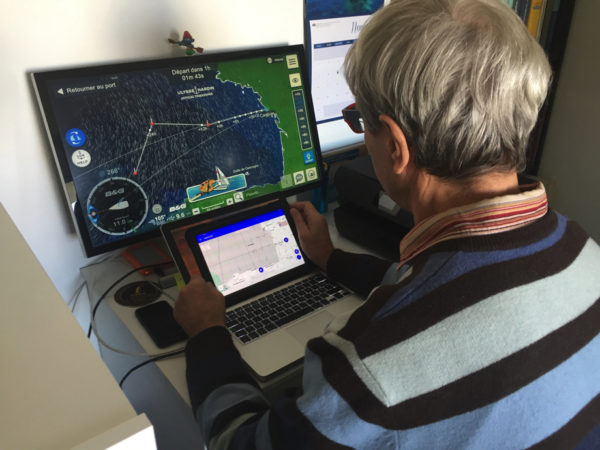
Non, it's not a joke ! SailGrib embark with Weather4D on the Vendée Globe 2020 with Virtual Regatta. The two friends Henri and Olivier have together developed a routing module directly integrated into the game.

Philippe Guigné, the creator of the online game Virtual Regatta, explains in an interview with Sails & Sailboats :

«… we want the virtual Vendée Globe to be aimed at the general public and it is therefore logical that we help newbies by providing new tools. So, For this edition we are offering a routing assistance system, directly integrated into the game, in partnership with SailGrib and Weather4D. These routings will first be simplified so that everyone can use them. In a second step, we will put in place more elaborate routings which will allow us to determine long-term strategies…"

A new development for the two leaders in navigation applications, weather and routing on mobile devices, which should allow them to popularize their applications to a wide audience, and perhaps trigger vocations among the large number of players who have never set foot on the water.

–––
https://www.facebook.com/groups/2417373995041174
–––

ECMWF weather data soon to be open to public [2th part]

Source : The Parliament Mag par Umberto Modigliani, ECMWF Deputy Director of Forecasts, responsible, with the department director, continuous production of forecasts and relations with users.

Early October, the European Center for Medium-Range Weather Forecasts (CEPMMT) will take a big step forward by making hundreds of its forecast maps available to everyone free of charge.
These changes are part of a broader European initiative to make public sector data free and open, encourage innovation and support a thriving, data-driven digital economy.

So far, full access to these forecast maps was restricted to national meteorological and hydrological services of ECMWF Member States and Cooperating States, to members of the World Meteorological Organization and commercial customers. Access was subject to a series of personalized licenses and high fees. Read more …

ECMWF weather data soon to be open to public [1first part]

Created in 1975 on the initiative of European Union members, The European Center for Middle Term Meteorological Forecast is an independent intergovernmental organization whose headquarters, to date, is located in Reading, England. The CEPMMT is funded by 22 Member States and 12 Associated States. It employs near 350 people, And its equipment as supercalulars is one of the most important in Europe. For fifteen years, CEPMMT forecasts tend to be among the most precise in the world, According to the verification data of the world meteorological organization (WMO). The CEPMMT is currently led by the French meteorologist Florence Rabier, who worked at the local weather-france weather office.

More, Since the advent of Brexit, The situation has changed. The United Kingdom is no longer part of the EU, The CEPMMET must move to a European country, And it may have, For weather data users, consequences… positives. Read more …