Episode 2 – Illustrations
Forecasts IFREMER (see Episode 1) available in SailGrib WR are of two kinds :
-
- Current forecasts from the MARS2D model
- Sea state forecasts (combined currents and waves) based on WW3 model
These files concern areas of the Channel and Atlantic whose coverage and resolutions are significantly different.
 Current IFREMER
- Northeast Atlantic
- Atlantic Channel
- East Channel
- West Channel
- Finistère
- South Brittany
- Aquitaine
 IFREMER WW3 waves & currents
- North Channel
- South Channel
- Northern Gascony
- South Gascony
- Pas de Calais
- Normandie
- Cotentin
- Armor
- Finistère
- South Brittany
- Loire
- Charentes
- Aquitaine
Utilisation
In coastal navigation, and even more in regattas along our French Channel-Atlantic coasts, the fineness of the meshes offered makes it possible to identify extremely precisely the veins of currents and counter-currents, particularly in narrow passages during periods of reversal of tidal currents. For example in the Iroise Sea :
Zooming in with the same model on Le Conquet and Pointe Saint-Matthieu, we can clearly distinguish the zones of currents and counter-currents at different times of the tide :
Same thing with the same model at Raz de Sein :
Routing
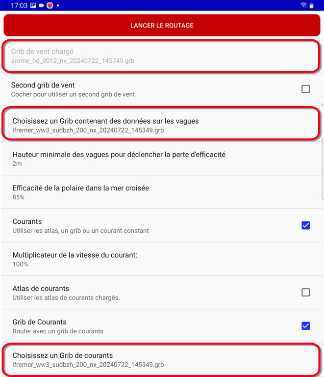
To combine an Arome HD type weather model and a very high resolution current and wave model, we can use in the routing parameters the same IFREMER WW3 model for oceanic wave and current data :
We can therefore clearly see all the benefits that can be gained from these ultra-high resolution models., subject to having sufficiently recent tablets and smartphones equipped with the essential capabilities to limit possible unexpected blockages in use.
–––
Episode 1 – Description
–––


