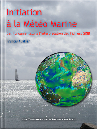
 The new tutorial « Introduction to Marine Weather » is available on Amazon Store for e-reader and cross-platform applications Kindle.
Complete revision of the work initially published in 2015, new, clearer and more readable layout in portrait mode, complete revision of the text, updating videos and illustrations.
From basic knowledge to interpreting GRIB files, an educational journey to help you better understand the weather, the one he will do, and master weather-routing and navigation applications, like SailGrib, Weather4D, and many others.
- 130 pages
- 15 videos
- 100 illustrations
This work replaces the previous one deleted.
[Update 10 th 2021] Update V.1.3 online on Amazon.fr. Video correction and links.

 The tome 2 from the Navy weather Introduction – The weather in the Mediterranean, is updated on the Play Store (Google Play Books)
 Two years after its launch for the Route du Rhum 2022, the cross-platform routing application dedicated to gaming Virtual Regatta Offshore has been the subject of an essential update in the run-up to the Vendée Globe. It has been available since September 29 th, (
